Sidi Salem (Markaz Sīdī Sālim)
Sidi Salem (سيدي سالم) is a city in the Kafr El Sheikh Governorate, Egypt.
The medieval Arabic and Coptic scholars identified the city with ancient Phragonis (ⲡⲉⲣⲟⲩⲱⲓⲛⲓ, Φραγωνις, الفراجون), although the archeological findings point out to Kom al-Khawaled 7 kilometers east of Sidi Salem.
* List of cities and towns in Egypt
The medieval Arabic and Coptic scholars identified the city with ancient Phragonis (ⲡⲉⲣⲟⲩⲱⲓⲛⲓ, Φραγωνις, الفراجون), although the archeological findings point out to Kom al-Khawaled 7 kilometers east of Sidi Salem.
* List of cities and towns in Egypt
Map - Sidi Salem (Markaz Sīdī Sālim)
Map


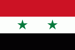
Country - United_Arab_Republic
 |
 |
| Flag of Egypt | |
The republic was led by Egyptian President Gamal Abdel Nasser. The UAR was a member of the United Arab States, a loose confederation with the Mutawakkilite Kingdom of Yemen, which was dissolved in 1961.
Currency / Language
| ISO | Currency | Symbol | Significant figures |
|---|---|---|---|
| EGP | Egyptian pound | £ or جم | 2 |
| ISO | Language |
|---|---|
| AR | Arabic language |
| EN | English language |
| FR | French language |